
 Helpful Posts:
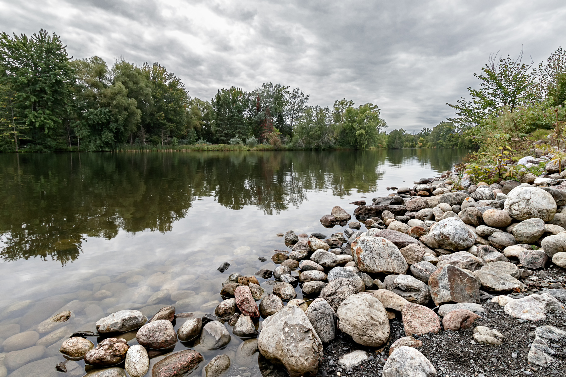
 A view of the Rideau river looking south from under the Vimy memorial bridge in Ottawa. Taken last Tuesday while on a hike with my grandsons.
Results 1 to 8 of 8
Thread: Rideau River
-
12th September 2020, 02:57 AM #1


- Join Date
- Apr 2015
- Location
- Ottawa, Ontario, Canada
- Posts
- 1,396
- Real Name
- André
Rideau River
-
12th September 2020, 01:08 PM #2

- Join Date
- Aug 2012
- Location
- Kerala, India
- Posts
- 13,862
- Real Name
- Nandakumar
Re: Rideau River
O, that is inviting me for a dip .....at what time of the day this has been clicked?
-
12th September 2020, 02:00 PM #3

- Join Date
- Jan 2011
- Location
- Osoyoos, British Columbia Canada
- Posts
- 2,819
- Real Name
- Trevor Reeves
Re: Rideau River
Just curious. Are the rocks naturally deposited. I always assumed the Rideau River was converted to a canal so was completely manmade. But then I know nothing about the river aside from the canal and locks portion in Ottawa.
Like the subtle colour, suits the cloudy sky.
-
12th September 2020, 05:09 PM #4Moderator

- Join Date
- Mar 2012
- Location
- Ottawa, Canada
- Posts
- 22,283
- Real Name
- Manfred Mueller
Re: Rideau River
Trevor - the Rideau Canal mostly runs along a natural waterway and locks and dams were installed only in locations where they were necessary for navigation. The completely man-made section runs from the Hogs Back Falls / Mooney's Bay area in Ottawa down to where the Rideau Canal meets the Ottawa River (it runs between the Parliament Buildings and the Chateau Laurier Hotel. The Rideau River ends about 1.6 km / 1 mile east of the canal at the Rideau Falls (definitely not navigatable). Originally Posted by tbob

The section of the Canal where this picture was taken is really at the very southern end of the City of Ottawa; where the canal and river are one and the same. It's not a part of town I get to all that often.
The rocks that are shown in the shot look like river rock; round and eroded. Given their location between the pathway and the river, I suspect that these were placed here to shore up the shoreline against erosion
-
12th September 2020, 05:38 PM #5
- Join Date
- Jan 2011
- Location
- Osoyoos, British Columbia Canada
- Posts
- 2,819
- Real Name
- Trevor Reeves
Re: Rideau River
Thanks. Satisfies my curiosity.
-
13th September 2020, 11:44 AM #6
- Join Date
- Apr 2015
- Location
- Ottawa, Ontario, Canada
- Posts
- 1,396
- Real Name
- André
Re: Rideau River
Thank you Nandakumar. The picture was taken shortly after 11:00 AM. There is a very popular beach a few kilometer downstream from where this picture was taken. The water is still warm enough for swimming but that will change soon Originally Posted by Wavelength

-
13th September 2020, 12:03 PM #7
- Join Date
- Apr 2015
- Location
- Ottawa, Ontario, Canada
- Posts
- 1,396
- Real Name
- André
Re: Rideau River
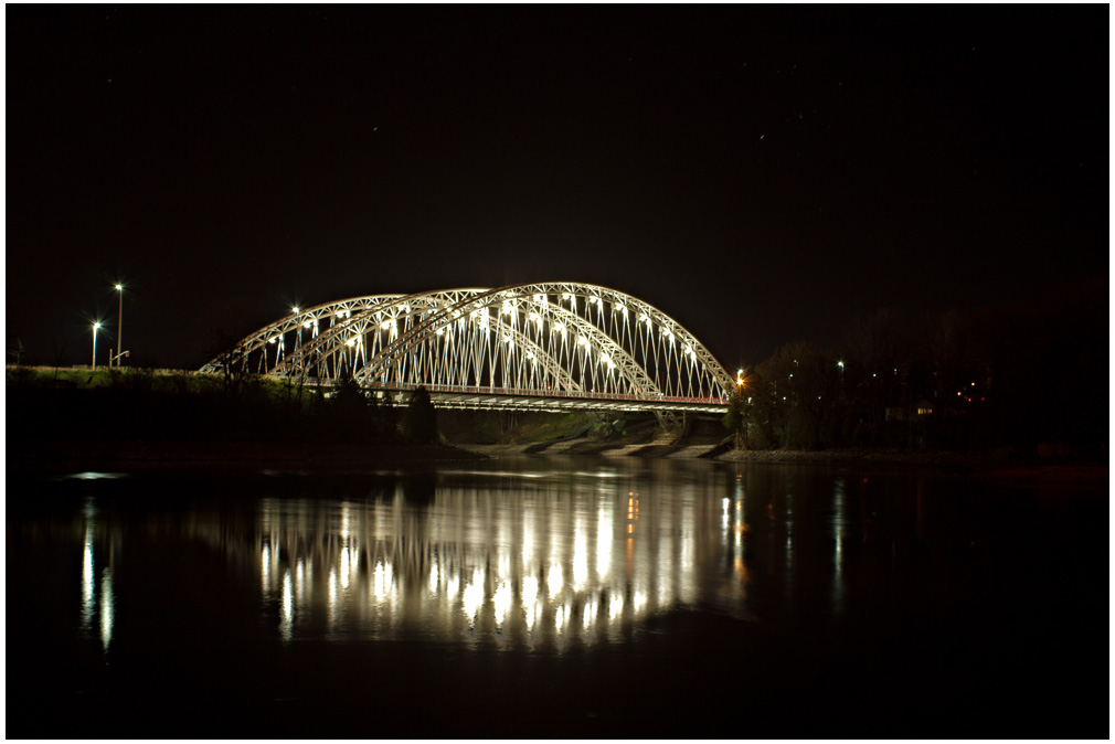
Thanks Trevor. The rocks were place there as part of the construction of the Vimy Memorial bridge across the Rideau river. The bridge was completed in 2014 and is a very interesting structure from an engineering point of view. It is also aesthetically pleasing. I took the picture from under the southern edge of the bridge. Originally Posted by tbob
This is picture that I took in November 2015 of the bridge at night.
-
13th September 2020, 12:11 PM #8
- Join Date
- Apr 2015
- Location
- Ottawa, Ontario, Canada
- Posts
- 1,396
- Real Name
- André
Re: Rideau River
Thanks for providing the info about the canal. Another "fun fact" about the canal is that it flows in two directions. It flows North from the Rideau lake into the Ottawa river and it flows South, as the Cataraqui river, from the same lake into the St-Lawrence at Kingston Originally Posted by Manfred M

 Reply With Quote